The drive from St. George to Bryce Canyon National Park covers roughly 125–162 miles one way, depending on your route, and takes about 2–3 hours without stops. The simplest path follows I-15 north to UT-20, then US-89 north to UT-12 east into the park. That’s it. One day is genuinely enough to see the canyon’s most iconic hoodoos, catch a sunrise or sunset, and be back in St. George by evening.
Distance and time at a glance: ~125–162 miles one way | ~2–3 hours driving | Primary route: I-15 → UT-20 → US-89 → UT-12
A few things to know before you leave:
- The Bryce Canyon National Park entrance fee applies per vehicle; an America the Beautiful pass covers it.
- Bryce sits at roughly 8,000–9,100 feet elevation. St. George sits at about 2,800 feet. Pack layers regardless of the season.
- Cell service gets spotty after Panguitch. Download your maps before you go.
- Rentalsinstgeorgeutah properties put you close to the I-15 on-ramp, making early-morning departures easy and stress-free.
Key Takeaways
The drive from St. George to Bryce Canyon takes about 2–3 hours one way, and a single well-planned day is enough to see the park’s best hikes and viewpoints.
| Point | Details |
|---|---|
| Drive distance and time | Roughly 125–162 miles one way; plan on 2–3 hours driving each direction. |
| Best route | I-15 north → UT-20 west → US-89 north → UT-12 east into the park. |
| Top hike for a day trip | Navajo Loop + Queens Garden combined (~2.9 miles) gives the best canyon experience in 2–3 hours. |
| Last gas stop | Panguitch, roughly 14 miles from the park entrance; do not skip it. |
| Pack for two climates | St. George sits at ~2,800 ft; Bryce’s rim is ~8,000–9,100 ft. Bring layers, water, and sun protection. |
| Base camp advantage | Rentalsinstgeorgeutah vacation homes in St. George offer full kitchens, private parking, and flexible check-in for early departures. |
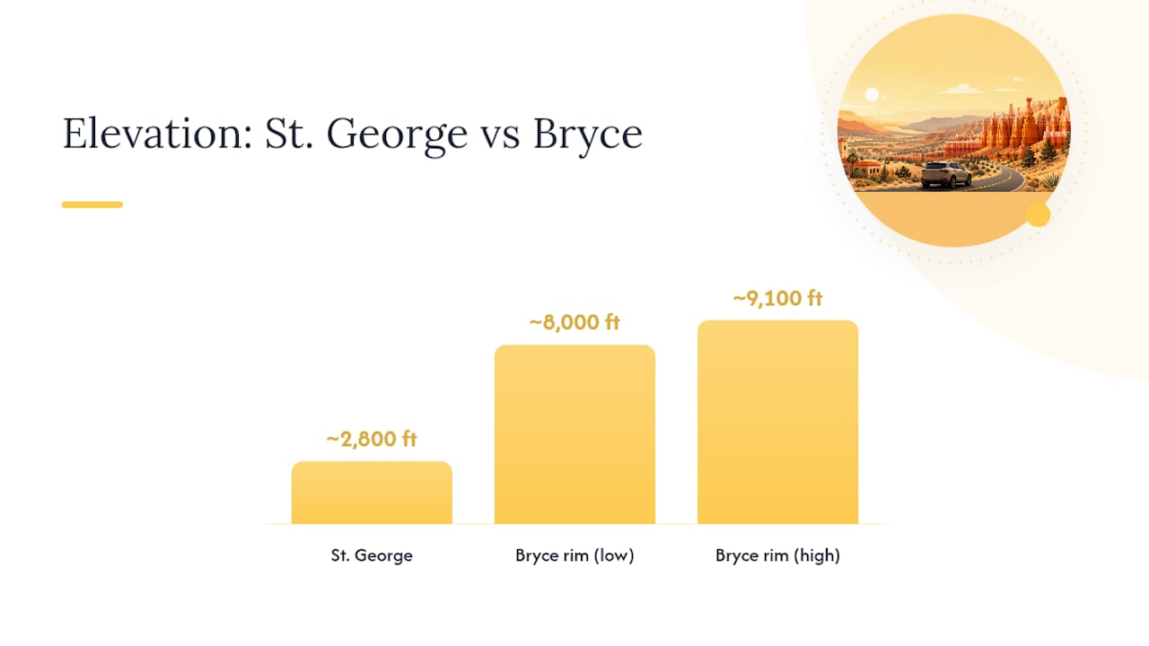
Table of Contents
- How do you drive from St. George to Bryce Canyon?
- What does a full day trip itinerary look like?
- What are the park fees, parking, and shuttle basics?
- Which hikes and viewpoints are worth your time on a day trip?
- How does the season affect the drive and your visit?
- Where should you stop for gas and food along the route?
- What should you pack for this day trip?
- What else can you see between St. George and Bryce Canyon?
- Why St. George makes a great base for this trip
- Wildlife and nature considerations for your trip
- Your St. George base camp for Bryce Canyon and beyond
- Sources
How do you drive from St. George to Bryce Canyon?
The primary route is straightforward. Take I-15 north from St. George to exit 95 (UT-20 west), follow UT-20 west to US-89 north, then turn east on UT-12 and follow it directly into the park. Total driving time on this route runs about 2 hours under normal conditions. Published estimates from route planners vary between roughly 125 and 162 miles depending on whether you measure from central St. George or the park’s main entrance.
Route comparison
| Route | Approx. miles | Typical drive time | Best for |
|---|---|---|---|
| Fastest: I-15 → UT-20 → US-89 → UT-12 | ~125 mi | ~2 hrs | Early starts, tight schedules |
| Scenic: via Cedar City → UT-14 → US-89 → UT-12 | ~125–162 miles | ~2–3 hours | Those wanting a mountain pass view |
| Full Scenic Byway 12 loop (via Panguitch) | ~162 mi | ~3 hrs | Photographers, leisurely pacing |
Turn-by-turn for the primary route:
- Head north on I-15 from St. George (about 40 miles).
- Take exit 95 for UT-20 west toward Panguitch.
- Follow UT-20 west for roughly 17 miles to the US-89 junction.
- Turn north on US-89 and drive about 10 miles through Panguitch.
- Turn east on UT-12 (Scenic Byway 12) and follow it about 14 miles to the park entrance.
A few navigation notes worth knowing: UT-12 has narrow stretches with steep drop-offs near the Aquarius Plateau. The Utah Department of Transportation (UDOT) occasionally runs seasonal maintenance on US-89 and UT-20, so checking UDOT road conditions before departure is worth the two minutes it takes. Cell signal drops significantly after Panguitch, so load your route on Google Maps or download the NPS park map offline before you leave.
Pro Tip: If you’re driving the scenic UT-12 route, slow down near the “Hogsback” section between Escalante and Boulder. The road narrows to a single lane with sheer drop-offs on both sides. It’s breathtaking, but not the place to be checking your phone.
What does a full day trip itinerary look like?
The best itinerary depends on one thing: what time you can leave St. George. Here are four realistic options.
Sunrise plan (leave by 4:30 AM)
- Depart St. George by 4:30 AM.
- Arrive at the park by 6:30 AM; head directly to Sunrise Point.
- Watch sunrise over the amphitheater (typically 6:00–7:30 AM depending on season).
- Hike Navajo Loop (1.3 miles) while the light is still golden and crowds are thin.
- Walk the connector trail to Queens Garden for a combined loop of about 2.9 miles.
- Grab breakfast at the Lodge at Bryce Canyon or your packed food at a picnic area.
- Drive to Bryce Point for the panoramic view by 10:00 AM.
- Leave the park by noon; stop at Red Canyon on UT-12 for 20 minutes.
- Back in St. George by 3:00–4:00 PM.
Full-day plan (leave by 7:00 AM)
- Depart St. George by 7:00 AM; arrive at the park around 9:00 AM.
- Stop at the Bryce Canyon Visitor Center for a trail map and current conditions.
- Hike Navajo Loop + Queens Garden combined loop (~2.9 miles, 2–3 hours).
- Lunch at the Lodge or a packed meal at Sunset Point.
- Drive the 18-mile scenic rim road to Rainbow Point in the afternoon.
- Return to Sunset Point for golden-hour photos around 6:00–7:00 PM.
- Depart by 7:30 PM; back in St. George by 9:30–10:00 PM.
Half-day plan (leave by 9:00 AM)
- Arrive at the park around 11:00 AM.
- Walk the Rim Trail from Sunrise Point to Sunset Point (1.8 miles, mostly flat).
- Short detour to Inspiration Point for the widest amphitheater view.
- Depart by 2:00 PM; back in St. George by 4:00–5:00 PM.
Sunset plan (leave by noon)
- Depart St. George around noon; arrive by 2:00 PM.
- Hike Bristlecone Loop (1 mile, easy) near Rainbow Point for the high-elevation forest.
- Drive north along the rim to Sunset Point by 7:00 PM.
- Watch sunset, then depart by 8:00 PM.
- Back in St. George by 10:00–11:00 PM (drive carefully in the dark on UT-12).
What are the park fees, parking, and shuttle basics?
Bryce Canyon charges a per-vehicle entrance fee. For the most current fee amounts, check the NPS official park page directly, as fees are updated periodically. An America the Beautiful Annual Pass covers the entrance fee for all NPS sites and pays for itself quickly if you’re visiting multiple parks on this southern Utah trip.
Key logistics at a glance:
- Entrance fee: Check the NPS site for current pricing; America the Beautiful pass accepted.
- Hours: The park is open year-round, 24 hours a day, though visitor center hours vary by season. Confirm current hours at the park hours page.
- Parking: Main lots at Sunset Point and Sunrise Point fill by 9:00 AM in summer. Arrive before 8:00 AM or use the shuttle.
- Shuttle: A free park shuttle runs seasonally between Ruby’s Inn and Bryce Point, stopping at all major viewpoints. Check the NPS shuttle page for current routes and seasonal availability before your trip.
- Visitor center: Located near the park entrance. Rangers here give current trail conditions and can recommend hikes based on your fitness level and available time.
- Accessibility: Accessible parking is available at major viewpoints; the Rim Trail between Sunrise and Sunset Points is paved and relatively flat.
Pro Tip: Parking at the visitor center and riding the shuttle to viewpoints saves you 20–30 minutes of circling lots during peak season. The shuttle runs frequently enough that the wait rarely exceeds 10 minutes.
Which hikes and viewpoints are worth your time on a day trip?
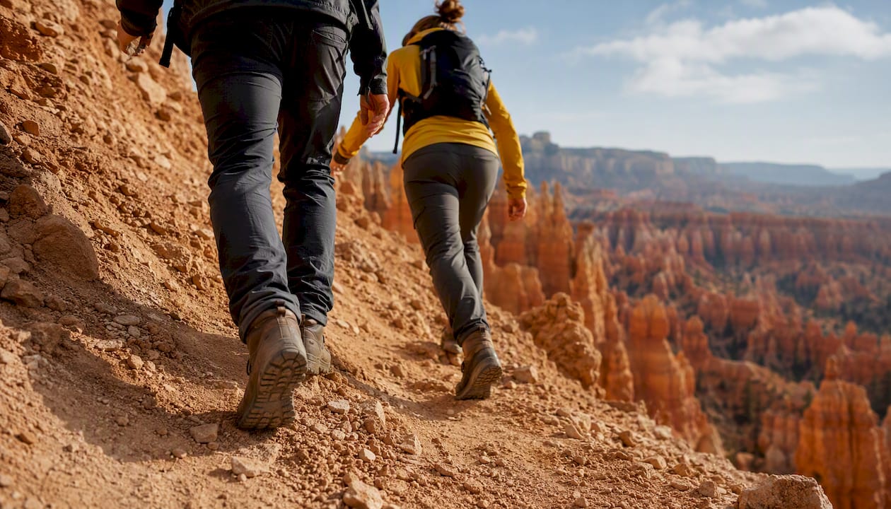
The NPS day hikes page lists all trails with distances and estimated times. For a day trip, focus on the trails below.
| Trail | Length | Typical time | Difficulty |
|---|---|---|---|
| Navajo Loop | 1.3 miles | 1–1.5 hrs | Moderate (steep switchbacks) |
| Queens Garden | 1.8 miles | 1.5–2 hrs | Moderate |
| Navajo Loop + Queens Garden | 2.9 miles | 2–3 hrs | Moderate |
| Rim Trail (Sunrise to Sunset) | 1.8 miles | 1–1.5 hrs | Easy (paved, mostly flat) |
| Bristlecone Loop | 1 mile | 20 minutes | Easy |
Must-see viewpoints:
- Sunrise Point: Best in early morning when the hoodoos glow orange-pink. The trailhead for Queens Garden starts here.
- Sunset Point: The most popular viewpoint; also the top of the Navajo Loop trail. Crowds peak mid-morning.
- Bryce Point: The widest panoramic view of the full amphitheater. Worth the short drive to the southern end of the main viewpoint road.
- Inspiration Point: Slightly less visited than Sunset Point but arguably the better angle for photography.
- Red Canyon: Not inside the park, but you’ll drive through it on UT-12. Pull over for 15 minutes. The red-rock arches frame the road in a way that surprises most first-time visitors.
Rangers consistently recommend combining Navajo Loop with Queens Garden as the single best use of 2–3 hours in the park. The descent into the canyon on Navajo Loop is steep but manageable for most adults; the Queens Garden connector brings you back up through a gentler grade. Elevation at the rim sits around 8,000 feet, so pace yourself on the ascent.
How does the season affect the drive and your visit?
St. George and Bryce Canyon feel like two different climates, because they are. St. George averages summer highs above 100°F; Bryce Canyon’s rim sits roughly 5,300 feet higher and stays 20–30°F cooler. That gap matters for packing and for timing your hike.
Seasonal overview:
- Summer (June–August): St. George is hot; Bryce is comfortable at 60–75°F during the day. Afternoon thunderstorms are common at the park from July through August. Crowds peak in July. Arrive early or use the shuttle.
- Spring and fall: The best shoulder seasons. Temperatures are mild at both ends of the drive. Spring brings wildflowers; fall brings aspen color on the higher stretches of UT-12.
- Winter (November–March): Snow at Bryce is stunning and the hoodoos look remarkable dusted in white. However, UT-12 can be icy, and some rim-road sections close seasonally. Check NPS conditions and closures before any winter trip.
Winter driving checklist:
- All-season or snow tires (chains may be required on UT-12).
- Ice scraper and snow brush in the car.
- Extra blankets and warm layers.
- Full tank of gas before leaving Panguitch.
- Downloaded offline maps (cell signal is unreliable in snow conditions).
- Check UDOT and NPS conditions pages the morning of your trip.
Elevation sickness is a real consideration for visitors coming from low-elevation cities. St. George sits at about 2,800 feet; Bryce’s rim is around 8,000–9,100 feet. Drink extra water, take the first hour slowly, and skip the longest hikes if you feel lightheaded.
Pro Tip: May and September are the sweet spots for this drive. Crowds are lighter than peak summer, temperatures are comfortable at both ends, and the light quality for photography is exceptional in both months.
Where should you stop for gas and food along the route?
The stretch between Panguitch and the park entrance has no gas stations. Fill up before you leave that town.
Service towns along the route:
- Hurricane, UT (~20 miles from St. George): Gas, fast food, and a grocery store. A good stop if you’re leaving early and want coffee or snacks before hitting the highway.
- Cedar City, UT (~55 miles from St. George): Full services including grocery stores, sit-down restaurants, and multiple gas stations. If you’re taking the scenic Cedar City route, this is your last comfortable meal stop.
- Panguitch, UT (~95 miles from St. George, ~14 miles from the park): The last full-service town before Bryce. Gas, a handful of diners, and a small grocery. This is your last fuel stop. Don’t skip it.
Inside the park, the Lodge at Bryce Canyon has a restaurant and a general store with snacks and basic supplies. Prices are higher than in town, as expected at any national park concession.
For RV and large-vehicle drivers: diesel is available in Cedar City and Panguitch. Parking for large rigs is limited at the main viewpoints; the visitor center lot has the most room.
Pro Tip: Pack a cooler with lunch and snacks from St. George. Eating at a picnic table at Sunset Point with the canyon in front of you beats any restaurant on the route.
What should you pack for this day trip?
The elevation change between St. George and Bryce means you’ll experience two different climates in one day. Pack for both.
Day-trip packing checklist:
- At least 2 liters of water per person (more in summer).
- Layers: a light jacket or fleece even in July; a warm coat in spring, fall, or winter.
- Sunscreen (SPF 30 or higher) and a wide-brim hat. UV exposure is intense at 8,000 feet.
- Sturdy, closed-toe shoes with ankle support. Sandals are not appropriate for Navajo Loop.
- Sunglasses.
- Snacks and a packed lunch.
- Charged phone with offline maps downloaded.
- Small first-aid kit with blister treatment.
- Camera or a phone with extra battery or a power bank.
- Cash or card for the entrance fee (if not using a pass).
Safety reminders:
- Stay on marked trails. The canyon walls are fragile and trail edges can crumble.
- Keep at least 100 yards from wildlife. For general guidance on safe wildlife encounters in southern Utah’s park corridor, the NPS wildlife encounter guidelines from Zion apply broadly across the region.
- Practice Leave No Trace: pack out all trash, don’t pick up rocks or plants.
- Tell someone your plan before you leave, especially for early-morning or late-evening trips.
Pro Tip: Hydration at altitude hits differently than at sea level. Start drinking water the night before your trip, not just the morning of. Dehydration is the most common reason visitors cut their hikes short at Bryce.
What else can you see between St. George and Bryce Canyon?
The route itself has several worthwhile stops that add 15–60 minutes without derailing your day.
- Red Canyon (UT-12, just before the park): Free to drive through. The red-rock arches frame the road and make for easy, no-hike photos. Add 15–30 minutes for a short walk on the Pink Ledges Trail.
- Parowan Gap: A BLM-managed site with ancient petroglyphs just off I-15 near Parowan. A quick 20-minute cultural stop for those interested in the region’s history.
- Cedar City: Worth a lunch stop if you’re taking the scenic route. The town has a good main street with local restaurants and is home to the Utah Shakespeare Festival.
- Panguitch historic strip: A charming small-town main street with brick buildings and local diners. Worth a 15-minute stretch stop.
- Kolob Canyons (Zion NPS unit): Accessible from I-15 exit 40, about 20 miles north of St. George. The Kolob Canyons section of Zion offers a short scenic drive and a couple of easy trails. Add this only if you have a full day and aren’t trying to reach Bryce by sunrise.
- Sand Hollow State Park: Located near Hurricane, Sand Hollow is a reservoir with red-rock scenery and water recreation. A good pre- or post-trip stop for families who want a swim.
Combining a Zion main canyon visit with a Bryce day trip in a single day is technically possible but not recommended. The two parks are about 1.5 hours apart, and both deserve more than a rushed hour. If you want both, plan two separate days.
Why St. George makes a great base for this trip
St. George sits at the center of southern Utah’s “Mighty 5” park corridor. From here, Bryce Canyon is roughly 2 hours, Zion National Park is under an hour, and Arches and Canyonlands are a longer but doable drive. That central position means you can run a different day trip each day without repositioning your base.
For day-trippers specifically, the right rental makes a real difference. Look for these features when booking:
- Private garage or secure parking: Keeps your car cool in St. George’s summer heat and protects gear overnight.
- Full kitchen: Pack your own lunch the night before and save $30–$50 per person compared to park concessions.
- Early check-in or flexible access: Critical for 4:30 AM sunrise departures. You need to be able to move quietly without waking the whole property.
- Laundry facilities: After a dusty canyon hike, being able to wash your clothes before the next day’s trip is a genuine comfort.
- Cooling and heating: St. George summers are intense; Bryce evenings are cold. A rental with reliable climate control means you recover well between days.
The accommodations guide for St. George covers the range of options available, from compact homes for couples to spacious family houses that sleep larger groups comfortably.
Wildlife and nature considerations for your trip
Bryce Canyon and the surrounding corridor are home to wildlife that can affect your visit in practical ways. Mule deer are common near the rim and often wander close to parking areas, especially at dawn and dusk. Utah prairie dogs are abundant in the meadows near the visitor center and are protected; feeding them is prohibited and can result in fines.
Pronghorn antelope occasionally cross US-89 between Panguitch and the park. Drive carefully at dawn and dusk on that stretch, when animals are most active. Collisions with deer and pronghorn are a real hazard on rural Utah highways at low-light hours.
Ravens are everywhere at the viewpoints and are bold enough to investigate unattended packs and open food containers. Keep food sealed and your pack zipped when you set it down.
Mountain lions live in the region but sightings are rare. If you encounter one, face it, make yourself large, and back away slowly. The NPS posts any active wildlife advisories on the park conditions page.
Spring and early summer bring wildflower blooms along the rim and on UT-12. The ponderosa pine forest between Red Canyon and the park entrance is particularly striking in May and June. Hummingbirds are common at the higher elevations through late summer.
One timing tip that changes the whole trip
The single best move for a St. George to Bryce Canyon day trip is leaving before 5:00 AM. Most visitors arrive between 9:00 AM and 11:00 AM, which is exactly when the main parking lots fill and the trails get crowded. Arriving at Sunrise Point before 7:00 AM means you’ll have the amphitheater nearly to yourself for the first hour. The light is better, the air is cooler, and the hoodoos glow in a way that midday sun simply doesn’t produce. The drive back in the afternoon is relaxed, and you’re home in St. George before dinner. That early start is the one thing most first-time visitors wish they had done.
Your St. George base camp for Bryce Canyon and beyond
A well-chosen vacation rental in St. George does more than give you a place to sleep. It sets up your entire day trip. Rentalsinstgeorgeutah offers spacious, family-friendly homes with full kitchens, private parking, and the kind of flexible check-in that makes a 4:30 AM departure actually possible. You pack your cooler the night before, load the car in your own driveway, and hit I-15 before the sun comes up.

Properties range from cozy two-bedroom homes for couples to large group houses that sleep families and friend groups comfortably. Every listing includes modern amenities, well-equipped kitchens, and dedicated support if anything comes up during your stay. Browse available vacation homes in St. George and check dates for your trip. If you’re planning multiple park days, a short-term rental in St. George gives you the flexibility to stay as long as the canyon keeps calling.
Sources
Check these official pages immediately before you travel. Hours, fees, shuttle schedules, and trail conditions change seasonally.
- Bryce Canyon National Park — Plan Your Visit: Shuttle
- Bryce Canyon National Park (NPS official site)
- Bryce Canyon National Park — Plan Your Visit: Hours & Seasons